
By Miriam G. Desacada
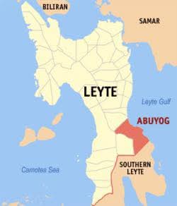
Catarman N.Samar–The National Committee on Geological Sciences (NCGS) officially declared the Biri Rocks Formation at Biri islands in Northern Samar province as a National Geological Monument (NGM), the seventh landform with unique geological feature in the country accorded with such distinct recognition.
The NCGS declaration was carried out during the launching ceremony of Biri Rocks as an NGM held on June 4 (Wednesday) at the Capitol in the capital town of Catarman, in the presence of national, regional, and provincial officials, geological experts, and the private sector.
Doctor Kevin Garas, senior geologist of the DENR’s Mines and Geosciences Bureau-Central Office and NCGS representative, presented the committee’s basis for designating Biri Rocks as an NGM, emphasizing its awesome geological characteristics, scientific importance, uniqueness, and breathtaking beauty.
Supporting the declaration were geological studies conducted by a team of researchers of the University of the Philippines–National Institute of Geological Sciences (NIGS), headed by Dr. Allan Gil Fernando.
They recognized Biri Rocks as a natural treasure worthy of national distinction because of its tilted marine sedimentary sequences of conglomerates, sandstones, siltstones, and shales formed around 15 to 20 million years ago. The formations were sculpted by tectonic and wave processes forming these picturesque seven islets to consist the Biri Rocks, geologists confirmed.
A unique feature of the Biri Rocks is the occurrence of phonolite (volcanic rock that forms from alkali-rich and silica-poor magma) and analcime clasts (fragments of the zeolite mineral analcime found within sedimentary rocks or volcanic rocks) in conglomerate and sandstone, both cemented in layers, which unravels the magmatic history of alkaline rocks in Northern Samar.
The NGM marker with geological evolution and declaration statement for Biri Rocks from the NCGS is set to be installed at the Magasang Rock Formation, the main islet of the Biri Rocks formation.
Governor Edwin Ongchuan also disclosed that the provincial government, with the help of NCGS, had taken bold step towards global recognition with Northern Samar’s bid to become one of UNESCO Global Geoparks, as attested by Dr. Ivan Anthony Henares, secretary general of UNESCO National Commission Philippines.
Ongchuan, Vice Governor Clarence Dato, and Biri town Mayor Amelita delos Reyes graced the NGM declaration event administered by NCGS member Dr. Fernando of UP-NIGS.
Other dignitaries were Dr. Mario delos Reyes, CEO and president of the Center for Neighborhood Studies in the Philippines, local historian and UP Department of History Professor Ian Christopher Alfonso, UP School of Archaeology Dr. Emil Charles Robles, Philippine gastronomy tourism crusader Clang Garcia, and Philippine Astronomical Society chairperson Ms. Martin Joy Irog.
The NCGS, under the Office of the President and chaired by the DENR-MGB, is a body created to promote and coordinate geological science initiatives within the country. It serves as an advisory and coordinating body for government agencies involved in geological sciences.
Biri Rocks designation as the country’s new NGM came after more than two decades since the last or 6th NGM declaration of St. Paul Limestone formation a karst landscape at the Puerto Princesa Subterranean River National Park in Palawan.
The country’s seven geological wonders, declared by NGCS as NGMs from 1983 to 2025 are the following:
- MONTALBAN GORGE in Rizal province, declared as NGM in 1983 — also known as Wawa Gorge, the Montalban Gorge is a limestone formation that formed from the accumulation of marine organism remains in a warm, shallow sea millions of years ago. It is considered a valuable site for studying geological processes due to its formation and the ongoing effects of water flow through its limestone structure.
- TAAL VOLCANO in Batangas province (1988) — recognized for its unique geological features, including the volcano within a lake within an island, and is also known for its frequent historical eruptions. The site is part of the Taal Volcano Protected Landscape, which was established to protect the area’s natural resources and biodiversity.
- CHOCOLATE HILLS in Bohol province (1988) — a geological formation of thousands of conical hills of green vegetation that turn chocolate brown during the dry season. These hills, located in the towns of Carmen, Batuan, and Sagbayan, are considered a remarkable example of conical karst topography.
- LA PAZ SAND DUNES in Ilocos Norte province (1993) — an 85-square-kilometer wide area of protected sandy coastal desert and beach located in Laoag, Ilocos Norte. The area is popular for recreational activities such as sandboarding and 4×4 vehicle riding.
- HUNDRED ISLANDS in Pangasinan province (2001) — located in Alaminos town of Pa